Edit: An eagle-eyed reader pointed out that the images below are of Harmony of the Seas, not its sister ship, Symphony of the Seas, as originally mentioned. We’ve updated this article accordingly.
Royal Caribbean’s Oasis-class cruise ships take top honors as the world’s largest cruise ships. The Oasis-class include Oasis of the Seas, Allure of the Seas, and Harmony of the Seas. Symphony of the Seas — Royal Caribbean’s newest ship and the fourth in the class — is currently under construction, set to sail in April 2018.
The size of these ships can’t be overstated. It total, the typical Oasis-class ship will measure nearly 1,200 feet and carry nearly 7,000 people!
We recently uncovered a cool way to get a look at one of the newest ships in the fleet — Harmony of the Seas.
Most people are familiar with Google Maps and their extensive satellite photos covering the entire planet. We took a look at the shipyard in France where Royal Caribbean had the Harmony of the Seas built to see if we might see anything.
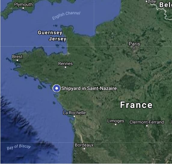
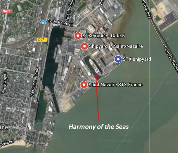
The shipyard is in Saint-Nazaire, France and specializes in super-sized projects like these. But when we took a look using Google Maps, there was nothing to see. No sign of any ships at all.
Then we switched over to “Lite Mode” in the program. Lite Mode is a version of Google Maps that uses less resources. It’s designed for slower computers, but we know from experience that it sometimes has different satellite photos than the regular version of Google Maps. (Note: The same trick works in Google Earth.)
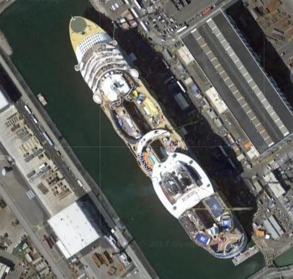
There, we saw something big. Real big. It’s Royal Caribbean’s Symphony of the Seas Harmony of the Seas, sitting at the shipyard, still under construction. And the detail you can see is amazing.
Here’s the entire ship, zoomed in:
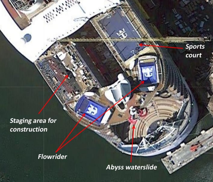
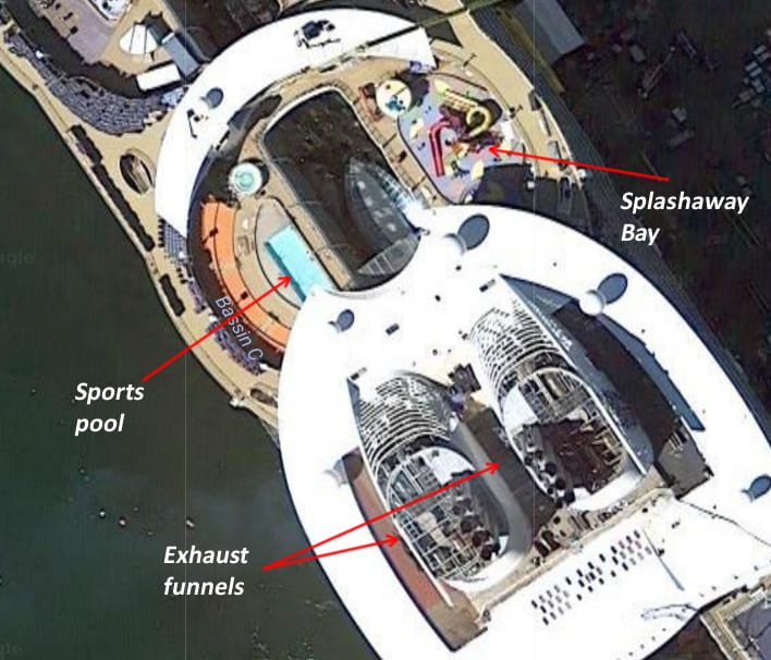
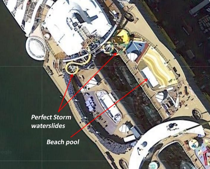
But you can zoom in further, seeing all the details of the ship’s top deck. Here you can see the famous Flowrider pools, sport court, and the Abyss waterslide. Where there is a current staging area for construction is where the mini-golf course goes.
Moving further forward, you can see the exhaust funnels wrapping around the Windjammer buffet. You can also clearly make out waterslides and pools.
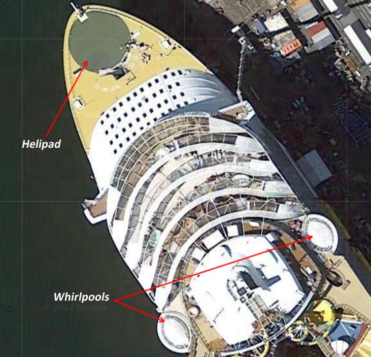
Finally, all the way forward you can see the ship’s helipad and the distinctive cantilevered whirlpools that jut out on each side.
Harmony of the Seas is now homeported in Port Everglades, Florida, offering trips to the Caribbean.
Satellite photos courtesy of Google Maps
")


")
")


")